Tutorials
Make shadow analysis diagrams with Chaos Vantage
In the pre-design stage, architects usually conduct shadow analysis and make sun path diagrams. This helps in understanding how sunlight interacts with space and forms, enabling them to design more functional and energy-efficient buildings. By knowing the orientation of the sun and tracking the movements of the shadows through the days and seasons, adjustments can be made in the design to capture more light and warmth from the sun or prevent overheating. For example, placing large windows on the side of the building that has more sunlight during the day. This, along with other considerations like wind study, nature around, etc., contribute to a thoughtful and site-specific design.
With advancements in technology, there are many software that architects now can use to make sun path and shadow analysis, but in my recent project, I used one of the latest and easiest ways that I am going to describe in this article. Thanks to the Chaos Vantage, we can make sun diagrams and track shadow movements based on the exact time zone and season. I think this method can be interesting and useful for both architects and archviz artists.
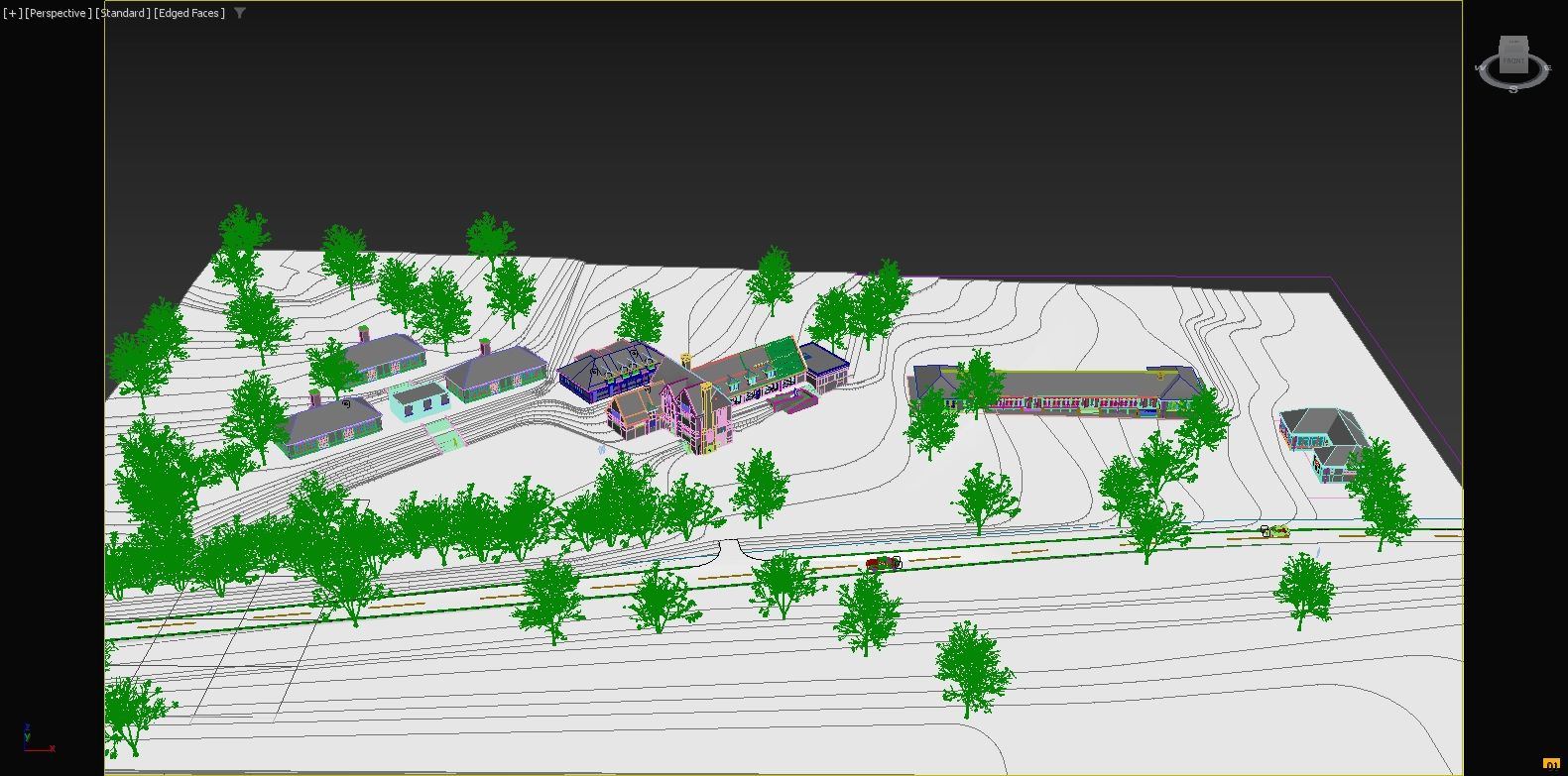
01. In the first step, you need to model your building in 3D software which you are comfortable and for me, it is 3Ds max. The building and the site should be in the real geographical orientation and as the model is near to the real world the outcome will be more realistic and accurate. the surroundings of the site including the next and front buildings and even trees and plants are very important as they might put a shadow on your building during certain times of the day. The surrounding buildings don't need to be modelled in high detail, and just their overall shape and exact size can be enough, however, if time allows and for a more artistic outcome adding some detail to the surroundings can be beneficial. My project was Western Park Open Air School, which is in a natural park, having no nearby buildings but set in an interesting topography.
With advancements in technology, there are many software that architects now can use to make sun path and shadow analysis, but in my recent project, I used one of the latest and easiest ways that I am going to describe in this article. Thanks to the Chaos Vantage, we can make sun diagrams and track shadow movements based on the exact time zone and season. I think this method can be interesting and useful for both architects and archviz artists.
01. In the first step, you need to model your building in 3D software which you are comfortable and for me, it is 3Ds max. The building and the site should be in the real geographical orientation and as the model is near to the real world the outcome will be more realistic and accurate. the surroundings of the site including the next and front buildings and even trees and plants are very important as they might put a shadow on your building during certain times of the day. The surrounding buildings don't need to be modelled in high detail, and just their overall shape and exact size can be enough, however, if time allows and for a more artistic outcome adding some detail to the surroundings can be beneficial. My project was Western Park Open Air School, which is in a natural park, having no nearby buildings but set in an interesting topography.
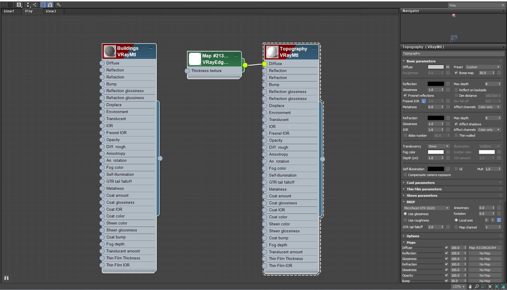
02. In the second step create a simple Vray material for the whole scene, however, you can be more creative and depending on your preference, you can make vibrant colour shadow diagrams, but a simple grey colour can be good enough for it. In my case, I used a simple grey with a slightly darker tone for buildings and made a copy of the material with a bit lighter colour for the landscape. I also
used a Vray Edge text in the diffuse node of the landscape material to enhance the visibility of the topography edges, but it depends on your vision and can be adjusted according to your specific goals.
used a Vray Edge text in the diffuse node of the landscape material to enhance the visibility of the topography edges, but it depends on your vision and can be adjusted according to your specific goals.
03. In the third stage, you have two alternatives. you can either export your scene and open it in the Chaos Vantage or you can set your render engine as Vray GPU and start the live link. Having chosen one of the methods, now you have your file opened in Vantage and probably the scene is completely black as there is no lighting source in the scene.
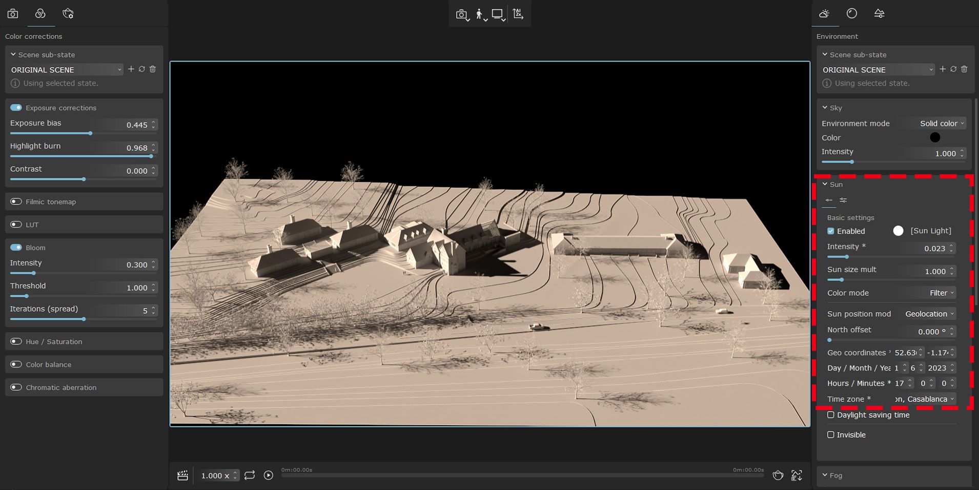
Go to the environment tab on the right side of the Vantage interface and open the Sun dropdown menu then turn on the Sun by checking the Enable box. To control the amount of light and avoid overexposure you can decrease the intensity of the sun, or you can go to the Colour correction tab on the left side and change exposure Bias and control the Highlight burn and Contrast of the scene.
Go to the environment tab on the right side of the Vantage interface and open the Sun dropdown menu then turn on the Sun by checking the Enable box. To control the amount of light and avoid overexposure you can decrease the intensity of the sun, or you can go to the Colour correction tab on the left side and change exposure Bias and control the Highlight burn and Contrast of the scene.
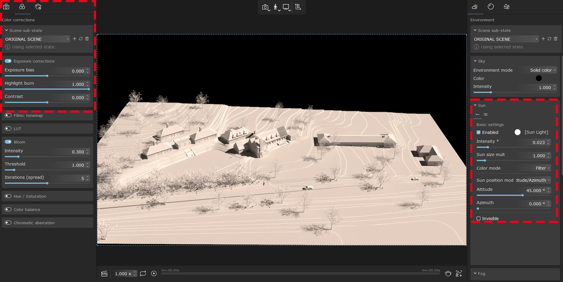
04. Now you have set your overall exposure and have smooth sunlight. It is time to position the sun accurately to see the shadow directions. In the sun options, set the Sun Position in Geolocation.
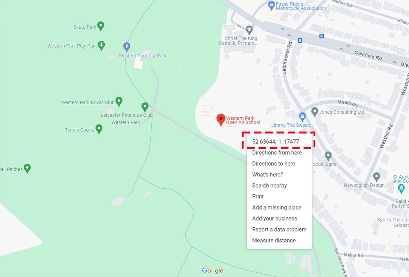
Again, I need to remind you that you need to ensure your model is oriented correctly in a real-world direction. Normally, architects look at their site towards the North and to do so, the north should be at the top of your screen when you are modelling your site, or you can adjust it when the modelling process is done. For improved accuracy, it is advisable to specify the geocoordinates of the site within Chaos Vantage. Determining the geocoordinates is a straightforward process; simply locate your site on Google Maps, right-click on the site location, and you will find the geocoordinates in the first line. Copy and paste this information into the designated geocoordinate section in the Chaos Vantage sun-setting options.
Again, I need to remind you that you need to ensure your model is oriented correctly in a real-world direction. Normally, architects look at their site towards the North and to do so, the north should be at the top of your screen when you are modelling your site, or you can adjust it when the modelling process is done. For improved accuracy, it is advisable to specify the geocoordinates of the site within Chaos Vantage. Determining the geocoordinates is a straightforward process; simply locate your site on Google Maps, right-click on the site location, and you will find the geocoordinates in the first line. Copy and paste this information into the designated geocoordinate section in the Chaos Vantage sun-setting options.
05. When you set the sun's position in Geolocation, now all you need to do is choose the time zone and specify the exact date in the drop-down option. In my case, considering my project location in England, I chose Western Europe time/GTM, London, as the time zone, used the Geo Coordinates that I got from Google Maps, set the year to 2023, and conducted experiments with various seasons and different times of the day.
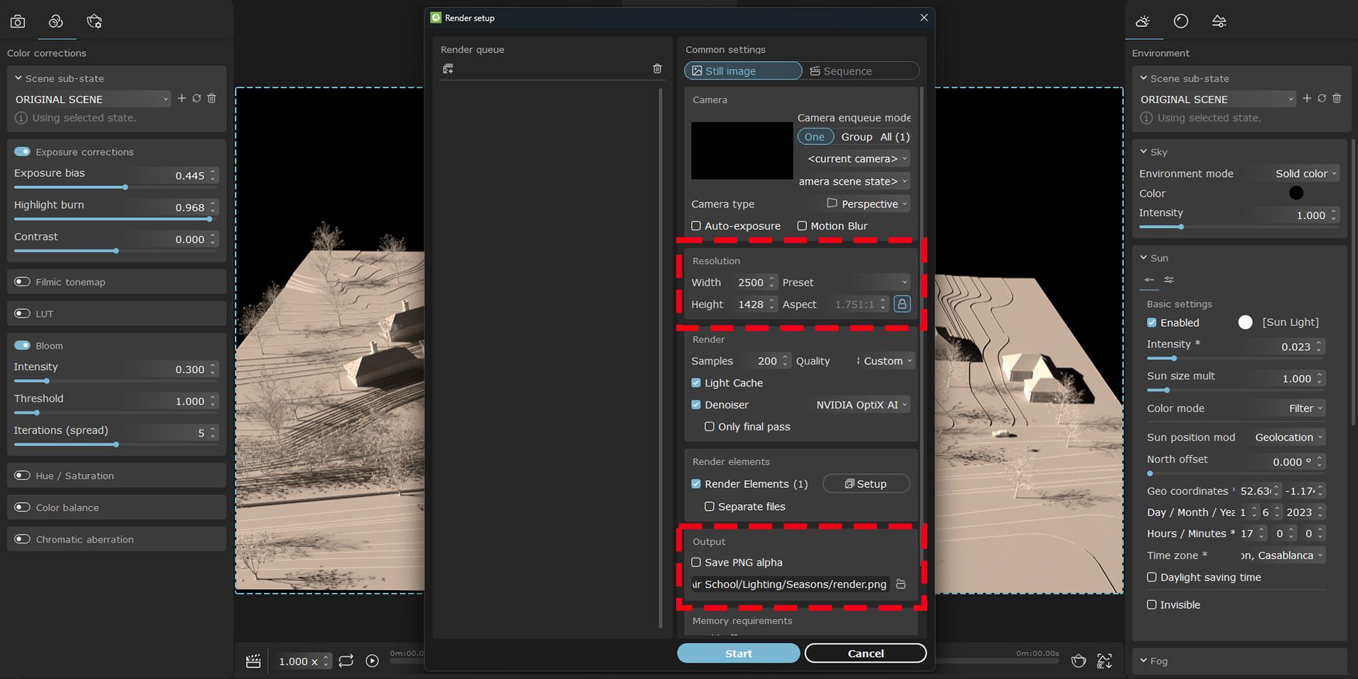
06. In the last stage just set the render setting according to your desired size and quality, choose the output format and folder, push the render button and enjoy the result. Once the rendering is complete, you can change the time and date, capturing multiple shots depicting different times of the day and various seasons throughout the year.
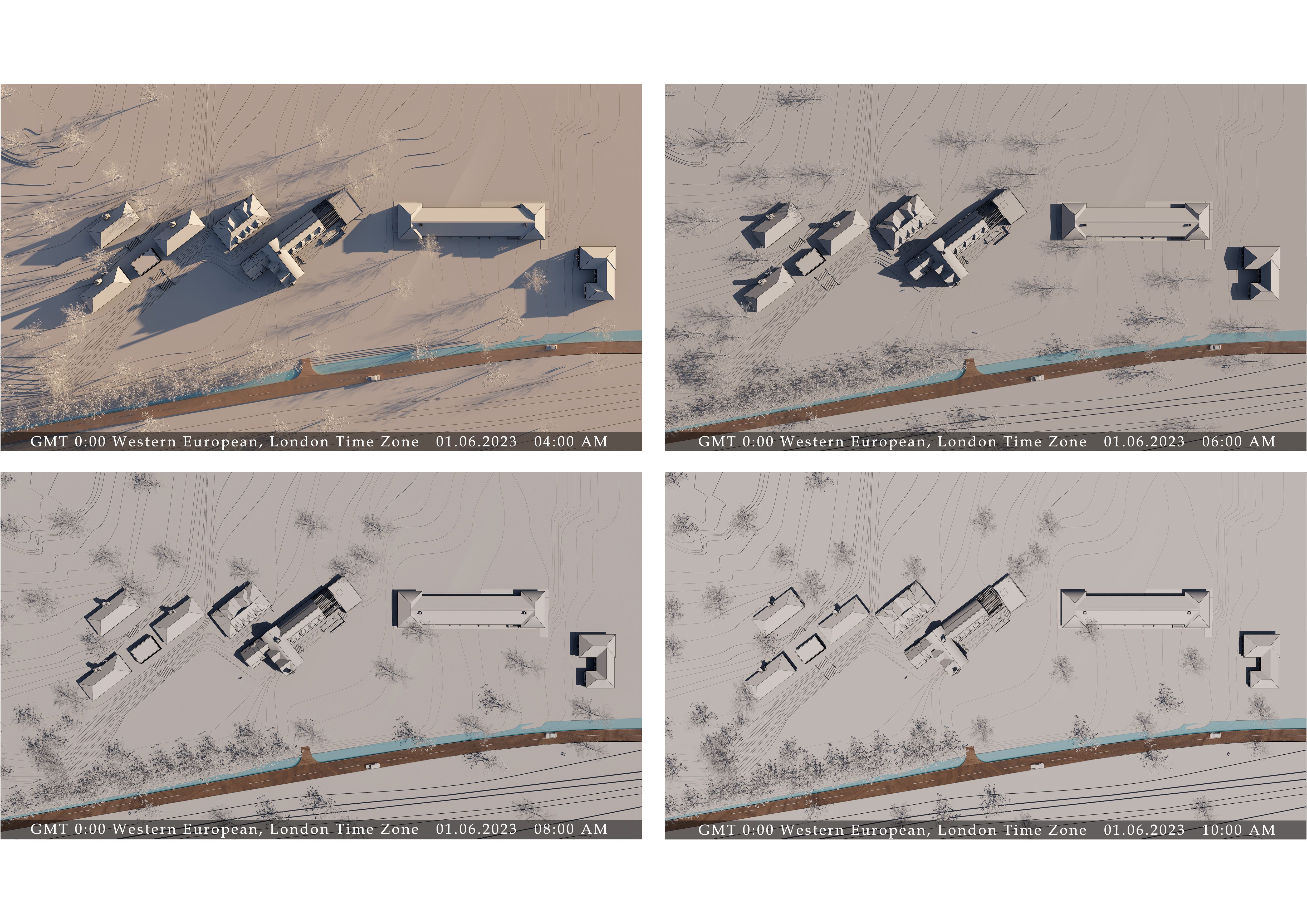
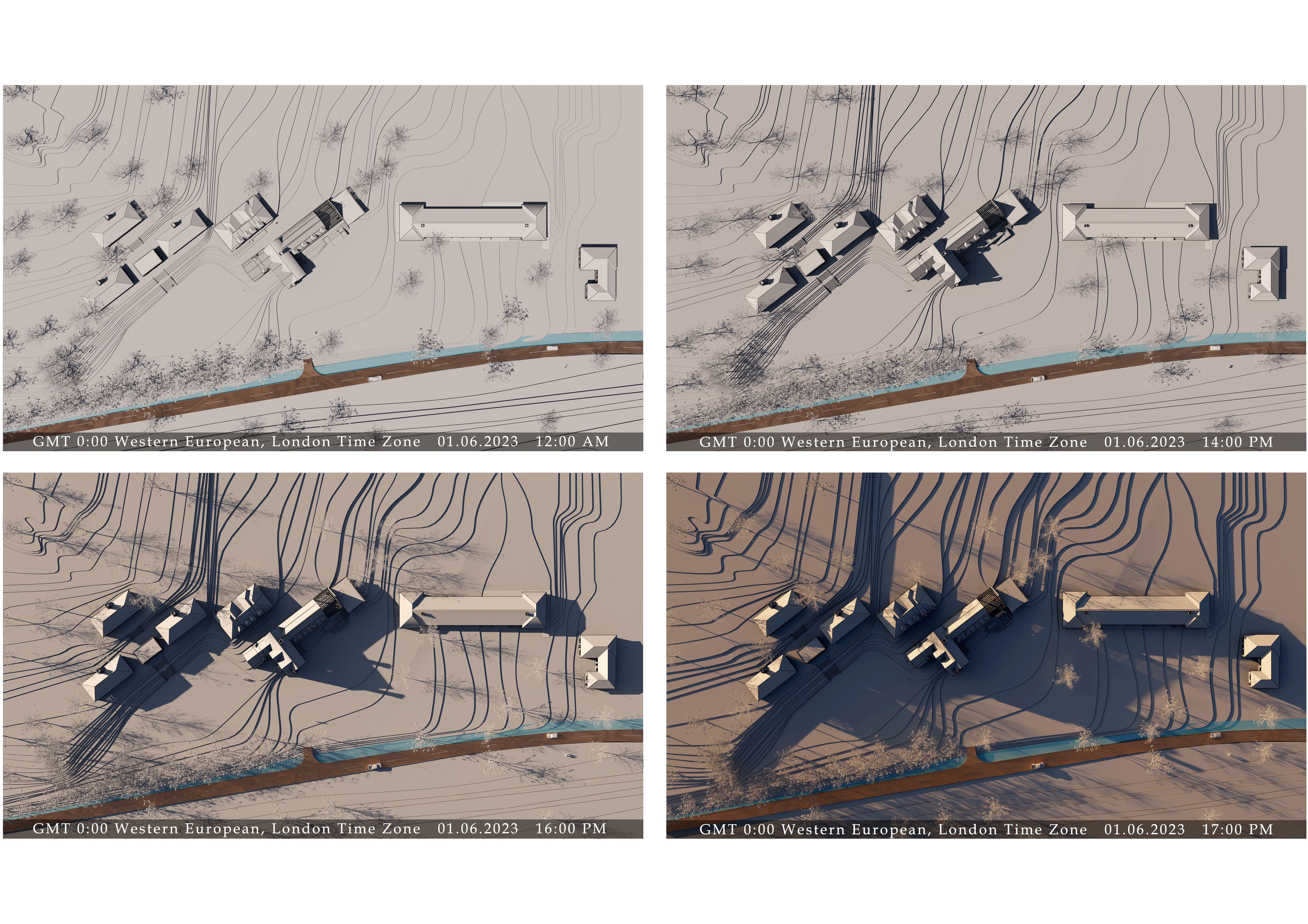
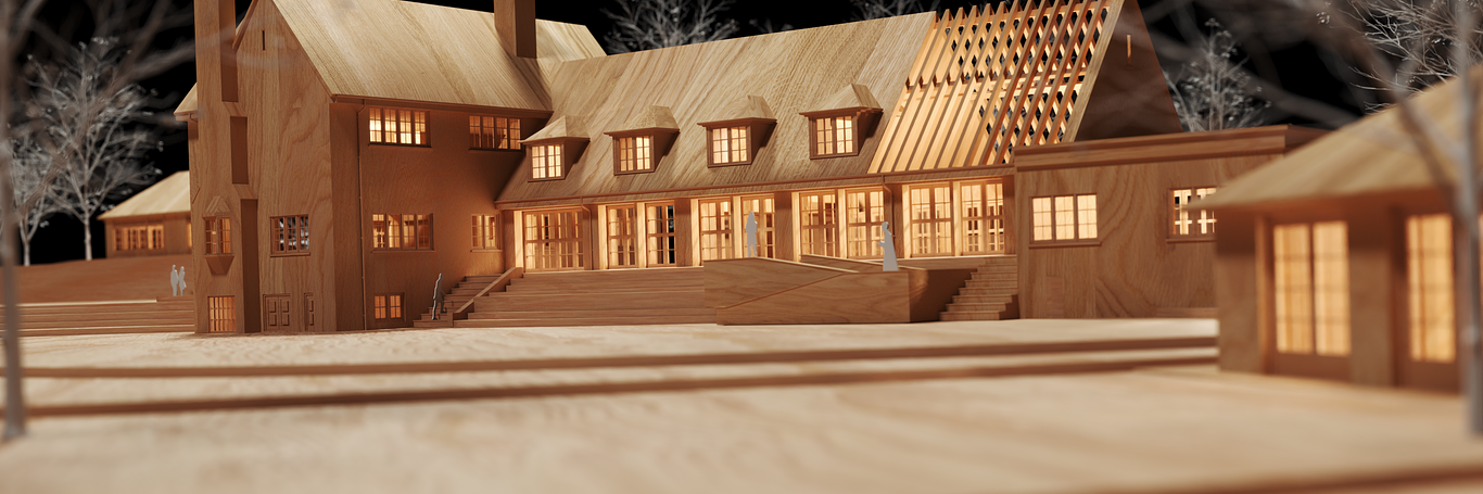
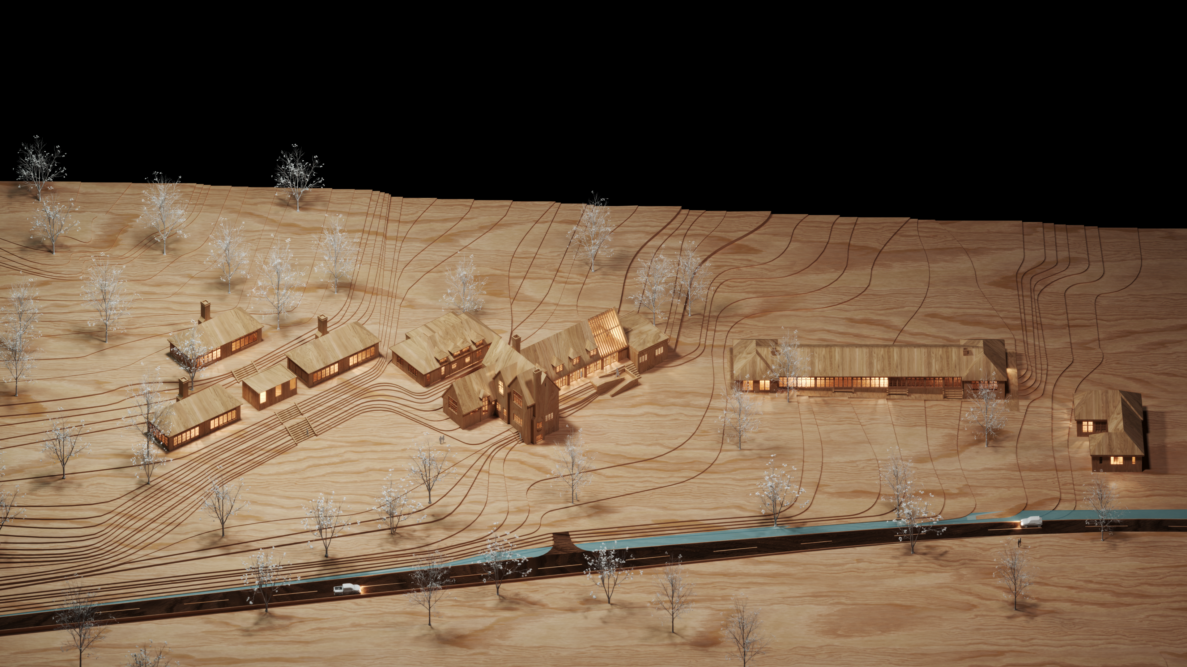
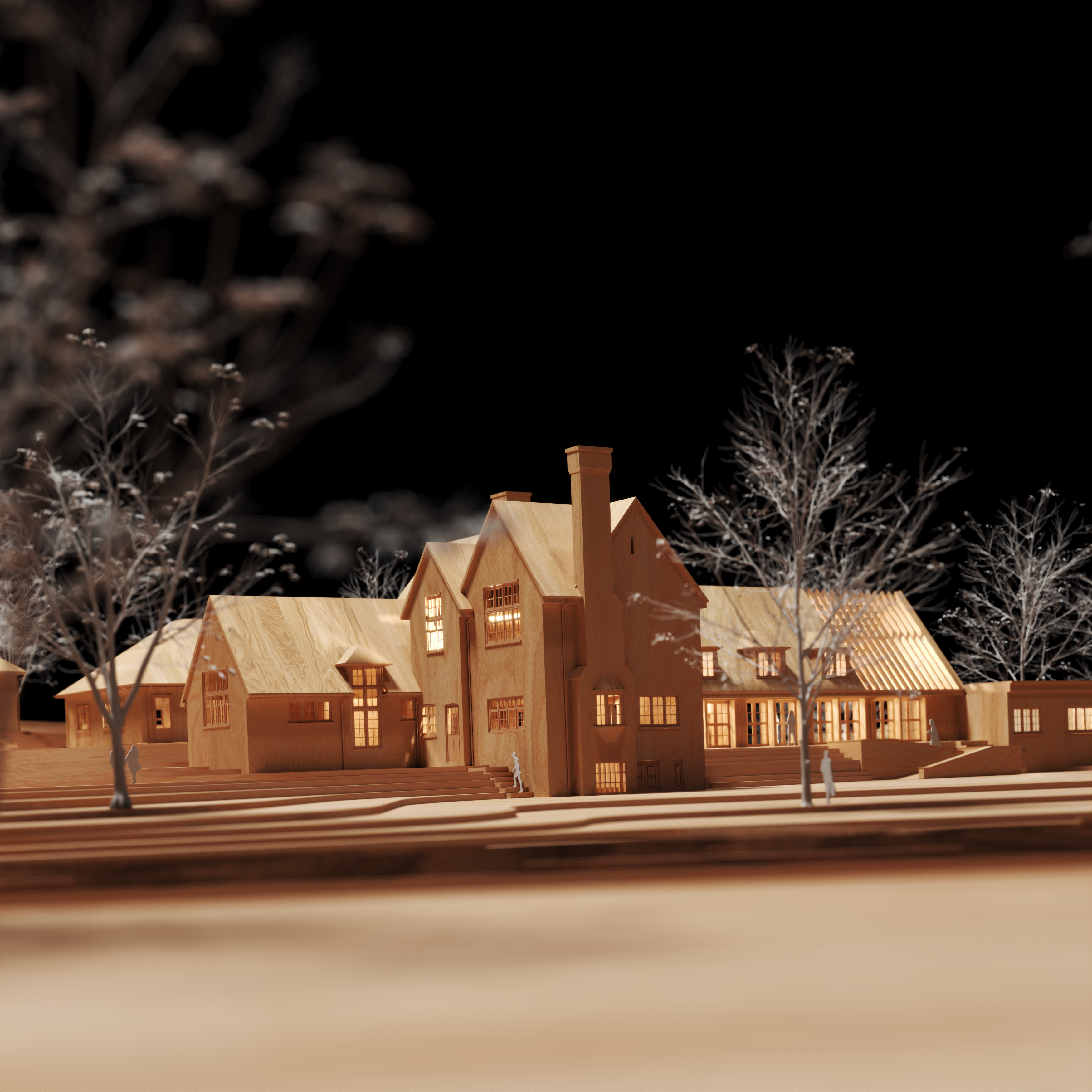
07. As my site is old-school, where natural light is a very important factor in educational places, this experimentation allows me to determine precisely from which directions and when I can capture the maximum sunlight and where should I be concerned about overheating. This valuable insight enables me to adjust my design proposal, accordingly, optimising the use of natural light in my design. Following experimentation with shadows, I incorporated a wood texture and positioned cameras at various angles to generate architectural-style renders from the project. This approach provided a compelling and captivating perspective of the space.
Thank you for reading.
Reza Eftekhari
Reza Eftekhari
You must be logged in to post a comment. Login here.